The last week has seen destructive weather across South Australia, with hail, flooding, lightning and wind wrecking havoc. The CFS and SES have been out in force, despite the current statewide lockdown, to ensure everyone stays safe. Once again, we thank all those who are involved with the SES and CFS, who working through incredibly tough conditions, for the safety of all South Australians.
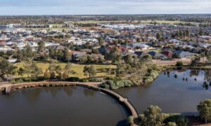
Saturday’s widespread damaging winds resulted in significant tree and property damage across Adelaide, particularly the southern suburbs. SES volunteers attended around 650 jobs across Adelaide and South Australia.
Bureau of Meteorology Senior Meteorologist, Tina Donaldson said South Australia experienced a wet and very windy few days due to the passage of multiple low pressure systems and cold fronts since Thursday.
Another front is moving across the south east of the state today.
“On Saturday we saw widespread damaging and locally destructive winds, including potentially multiple small and fast-moving tornadoes, causing significant tree and property damage across Adelaide particularly, the southern suburbs.
“At this stage, looking at radar evidence and damage patterns, they indicate there were multiple small and fast-moving tornadoes along a cold front that moved through around midday. The showers and thunderstorms associated with the front produced narrow paths of damaging to destructive winds,” said Tina Donaldson
Some of the most significant observations:
- Gusts of 90-100 km/h were recorded across parts of southern South Australia, including Adelaide and the Mount Lofty Ranges.
- The highest gust recorded in the Adelaide area was 95 km/h at Adelaide Airport on Saturday evening.
- The highest gust in SA since Thursday was 107 km/h at Cape Borda and 135 km/h Neptune Island.


“Large amounts of small hail settled on the ground could have be mistaken for snow, particularly in the Adelaide Hills region, however observations suggest small hail was more likely. Small hail was also reported across the Adelaide metropolitan area,” said Tina Donaldson.


“This system also saw showers and rainfall across the state. The highest rainfall totals in the 24 hours to 9am on Sunday were 42mm at Ashton, 40mm at Lenswood, and 33mm at Balhannah. 12mm was observed at Adelaide West Terrace/ngayirdapira.
“Heavy rainfall across the Mount Lofty ranges has resulted in some stream rises. We are now starting to see the impacts of recent rain, with a Minor Flood Warning issued for the Bremer River, below Hartley.
“Today, a Severe Weather Warning for Damaging winds, with gusts in excess of 90 km/h, remains for people in the Mount Lofty Ranges, Kangaroo Island, the Upper and Lower South East, the Mid North and the Murraylands districts. This is associated with the passage of another cold front currently moving across the south of the State. The risk of damaging winds should ease by early this evening.
“Looking ahead, warmer temperatures are forecast for Monday and Tuesday, with warnings for damaging winds are likely again on Tuesday,” said Tina Donaldson.
If you’re outdoors today, please continue to be careful as there is still a few trees dropping limbs, and there may be some power lines hanging where they don’t normally hang. If you’re cleaning up around your property, just remember to go slowly and carefully. No one needs injuries on top of all of this!
For all SA weather warnings, visit the website.


More News