Adelaide is in for a mostly settled start before the weather turns more changeable later this week, with warmer days, a burst of showers and possible thunderstorms, then another gusty cool change by Monday.
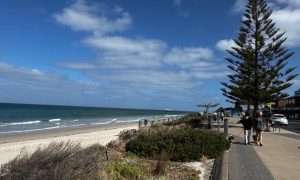
Today is shaping up as the calmest day of the seven-day stretch for Adelaide, with mostly sunny skies and a top of 25 degrees in the city. Suburbs will sit in the low to mid-20s, from 22 in Mount Barker to 26 at Elizabeth, while southeasterly winds pick up through the afternoon. It’s a good day to be outside, but the UV is expected to hit a very high 10, so sun protection will be important from 9am to 5pm.
Wednesday keeps things fairly comfortable, with a partly cloudy sky and a warmer maximum of 29 degrees after a cool overnight minimum of 14. Easterly winds will keep the air moving, but overall it should still feel like a pleasant late-spring day across Adelaide. By Thursday, though, the week takes a wetter turn. Cloud will linger through the day, showers are likely, and there’s also the chance of a thunderstorm developing in the afternoon or evening. Temperatures will climb to 31 degrees ahead of the change, with brisk east to northeasterly winds before conditions begin to shift.
Friday looks cooler and more unsettled in the wake of that system, with a medium chance of showers, most likely in the morning, and a top dropping back to 25 degrees. Winds will swing from northerly to west to southwesterly during the day, bringing that classic post-change feel across the city. Adelaide heads into the weekend under partly cloudy skies on Saturday, with temperatures rebounding to 28 degrees and only a slight chance of rain, making it the better pick for outdoor plans.
Sunday brings another round of active weather, with showers likely and the chance of a thunderstorm as temperatures push back up to 31 degrees. Winds will strengthen and turn west to northwesterly during the morning, so it could feel quite blustery at times. Then on Monday, a much cooler change moves through, with a shower or two, fresh westerly winds tending southwesterly, and a top of just 21 degrees. After several warm days, that will be a noticeable drop and a reminder that spring can still turn quickly in Adelaide.
Across regional South Australia, the broader pattern is far more lively, especially in the west and north. The state starts the week under a ridge of high pressure, but a low and trough moving in from Western Australia will spread showers and thunderstorms across more districts through mid to late week. On Tuesday, showers and storms are expected in the west, with severe thunderstorms possible in the far northwest, while patchy frost is also possible early in the South East.
Wednesday keeps storms going in the west, with the risk of severe activity in the far west, while eastern districts warm up. By Thursday, showers and isolated thunderstorms are forecast to extend across most of the state before clearing from the west later in the day, with severe thunderstorms possible in the north. Friday sees that wet weather contract to the far northeast, while much warmer conditions build statewide. Rainfall is expected to stay light in the east, but western districts could see 15 to 30mm, with local thunderstorm totals of 30 to 60mm and isolated heavier falls possible.
Happy Tuesday!
Warnings
Strong Wind Warning for the following area:
Far West Coast
Adelaide 7-Day Summary Forecast
Tuesday: Max 25°C – Mostly sunny.
Wednesday: Min 14°C, Max 29°C – Partly cloudy.
Thursday: Min 20°C, Max 31°C – Showers. Possible storm.
Friday: Min 17°C, Max 25°C – Possible shower.
Saturday: Min 15°C, Max 28°C – Partly cloudy.
Sunday: Min 21°C, Max 31°C – Showers.
Monday: Min 14°C, Max 21°C – Shower or two.
Related