Dependant on the time of year, time of day, and cloud cover we are convinced actual magic happens in the Yorke Peninsula.
The Yorke Peninsula Salt Lake Trail is bucket list stuff with views and surroundings that make you want to pinch yourself.
The Salt Lake Trail is a self-drive tour that will take you past stunning pink, orange, blue and white salt lakes. For those who want a bit more, there is also the opportunity to investigate the history of salt on the Yorke Peninsula. Interpretative signs are installed along the way.
On the trail you will have the opportunity to see 200 salt lakes that lay uniquely around Yorketown.
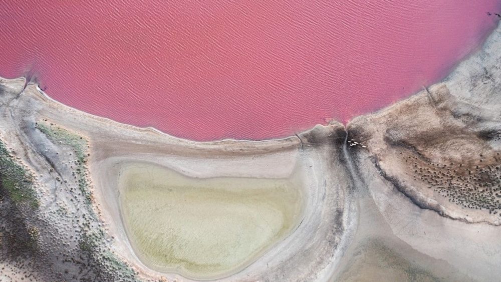
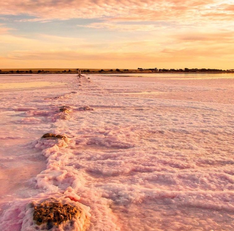
Find the eye-catching crystal formations and travel past some of the best vantage points for that perfect photo

Following the Trail
There are 4 different trails to choose from, depending on how much time you have to explore.
Each tour has different coloured signs to follow, and these are also numbered to help you keep on track. Refer to the Salt Lake Trail map (below) for estimated drive times and corresponding colours.
For the ‘Full Tour’, ‘Schools and Cemeteries’ drive and the ‘Short Drive’, the first coloured signs are all located on the corner of Boothill Station Road and St Vincent Highway (head towards Warooka).
The first blue sign for the ‘Lake Fowler’ drive is on the corner of Lake Fowler Road and St Vincent Highway (head towards Edithburgh).
Starting Point – Weaners Flat Reserve
The Salt Lake Trail begins at Weaners Flat Reserve, which is located on Stansbury Road in Yorketown and marked as ‘A’ on main map (below).
At Weaners Flat, head to the shore of Par Lake where you’ll find the main information sign, with details about the different tours as well as more information about the history of the salt on the Yorke Peninsula.
This driving route takes you past some of the best and accessible salt lakes on Southern Yorke Peninsula.
Interpretative signage highlighting the history of salt production in the area can be found at stops along the trail at Lake Fowler, Dhalliwanggu – Lake Sunday and Pink Lake.
Sunrise and sunset offer excellent photographic opportunties as the suns rays reflect on the surface of the lake, creating prisms of colour ranging from pink & orange, to silver & white.
Follow the complete circuit of the Salt Lake Trail, starting and finishing in Yorketown.
For those wanting a quick but satisfying tour of the best salt lakes surrounding Yorketown, follow this short drive.
Leaving from Yorketown’s Weaner Flat Reserve, this short circuit visits Domaschenz Lake, Geitz Lake & Pink Lake before returning to Yorketown.
If you’re short on time but want to maximise your salt lake visit, this part of the trail offers a snippet of Instagrammable photo opportunities that will leave you wanting more.
Yorketown and the surrounding areas were once a hive of activity. There were many more townships in the area than there are today, and several had populations in the hundreds. Salt and gypsum were major industries, employing thousands of workers, and individual farms also employed hundreds of labourers.
As industries became mechanised or closed down and work became scarce, many townships also faded, leaving only stone buildings and ruins behind. The Salt Lake Trail will take you past many beautiful lakes, and will also give you the opportunity to visit the ruins of these once thriving communities.
Find out more about what’s on in the Yorke Peninsula here.
More News