Adelaide is in for a grey, chilly stretch to close out July, with a few showers lingering through midweek before conditions settle into a mainly dry run and then turn a little more changeable again by Sunday.
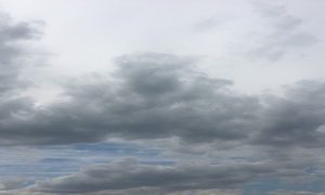
For today, Wednesday, the city will stay cloudy with a medium chance of showers, most likely through the morning and afternoon. It’s not shaping up as a washout, but it will be a cool day across the metro, with tops only reaching 14 degrees in the city, 13 at Elizabeth, 12 at Mount Barker, and 14 at both Glenelg and Noarlunga. Southwesterly winds should ease during the afternoon, helping things feel a little calmer later in the day.
Thursday keeps the cloud around, along with the chance of another light shower. Winds will be light, and Adelaide is expected to dip to 6 degrees overnight before reaching a top of 14 degrees. It’s the kind of winter day that looks fairly quiet overall, but still cool enough to keep the coat handy.
By Friday, Adelaide’s forecast turns a little steadier. Skies will remain cloudy, though rain chances drop right back. There is a chance of morning fog, especially about the northern suburbs, before another cool afternoon with a top of 15 degrees. Saturday brings one of the better windows of the week, with partly cloudy conditions and light winds after a brief northerly push in the morning. The city is forecast to range from 7 to 15 degrees, making it a decent day to get outside between winter layers.
Sunday signals the next shift. The morning is expected to start mostly sunny, but showers may return later in the day as winds freshen from the north and north-west. Temperatures will again sit between 7 and 15 degrees. That unsettled pattern lingers into Monday, with cloudy skies and a medium chance of showers continuing across Adelaide. By Tuesday, things should ease again to partly cloudy conditions, with just a slight chance of a shower and a slightly colder start of 5 degrees before another 15-degree day.
Across South Australia, the broader picture is being driven by a high pressure system moving over the Bight, helping showers ease behind an earlier cold front. For much of Wednesday, isolated showers will continue about the Agricultural Area, especially along exposed coasts and ranges, while the far southeast could see small hail early. Maximum temperatures are expected to stay below average across the state.
The chilly run continues into Thursday and Friday, with morning fog and frost becoming a feature in several districts, particularly on and east of the ranges. Parts of the North West Pastoral may also see frost on Friday, while light showers remain possible about southern coasts and ranges. By Saturday, much of the state should be mostly dry, although inland and Eyre Peninsula communities may wake to another frosty morning. Rainfall totals through to the end of Saturday are expected to stay modest, with less than 2 mm across the Northern Agricultural Area and south of the Pastoral districts, and 2 to 5 mm about the Southern Agricultural Area. Higher isolated totals of 5 to 10 mm are possible on windward coasts and ranges, and along the southern coast of the Lower South East.
For coastal conditions, Adelaide Metropolitan Waters will see southwesterly winds easing today, with seas falling below 1 metre around midday. Thursday and Friday look comparatively calm on local waters, before northeasterly winds pick up again on Saturday.
Happy Wednesday!
Warnings
Marine Wind Warning for Wednesday 29 July
Strong Wind Warning for the following area:
Lower South East Coast
Cancellation for the following area:
Upper South East Coast
Adelaide 7-Day Summary Forecast
– Wednesday: Max 14°C – Cloudy. Medium chance of showers, most likely during the morning and afternoon.
– Thursday: Min 6°C, Max 14°C – Cloudy. Medium chance of showers.
– Friday: Min 6°C, Max 15°C – Cloudy. The chance of morning fog about the northern suburbs.
– Saturday: Min 7°C, Max 15°C – Partly cloudy.
– Sunday: Min 7°C, Max 15°C – Mostly sunny morning. Medium chance of showers, most likely later in the day.
– Monday: Min 7°C, Max 15°C – Cloudy. Medium chance of showers.
– Tuesday: Min 5°C, Max 15°C – Partly cloudy. Slight chance of a shower.